Introduction
Data typically is stored in a GIS in one of two forms:
- Spatial data
- Attribute data
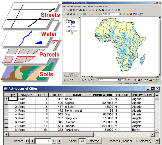
Georeferenced spatial data is arranged in layers (or themes), which could consist, for example, of a topographical map, streets, cities, buildings, vegetation and rivers.
Attribute data is related to an object or feature displayed in the layers. For example, each city in the cities layer could have ascribed attributes such as name, country, province / state, population and growth rate etc.
Students in the Forest Sciences use ArcGIS from ESRI, one of the world’s leading commercial GIS software providers. The access available to this software, both during modules and outside of the classroom, gives students an important advantage when later joining the workforce.