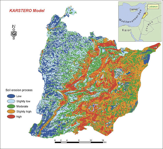
Please examine the map of Lebanon carefully!
If the purpose of a GIS was to predict soil erosion:
Task 3: Which three of the following layers would be most useful to include?
Task 4: Which combination of attributes would be most suitable to display on the map when presenting the results of the study to the local community?