In this task you were required to select layers or attributes that would be appropriate for a particular map or GIS.
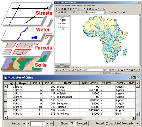
To complete the task you had to have understood the basic structure of data in a GIS, which was introduced at the beginning of the task. The questions emphasized the importance of not only being knowledgeable about the software, but also being knowledgeable in areas such as the science behind the subject, or the target audience. It should have become clear that although there can be many possible layers and attributes, those which are most appropriate depend on the purpose of the map or GIS.
Since the questions in this OSA could not involve the direct use of ArcGIS software, they obviously do not fully represent the Forest Sciences curriculum of the GIS modules. However, they can give you a general sense of whether you have understood some of the aspects that must be taken into account when using a GIS. As the questions were geared towards using GIS for a specific purpose, they also give you an idea of the type of jobs that could await you, in case you choose this field of study.
Aim of the task
This task should have given you insight into a few of the endless possibilities of implementing GIS in forestry and environmental science. GIS is applied in scientific research, as well as the public and private sectors and can incorporate ecological, social, and economical aspects. The optimal use of this valuable tool combines technical know-how with extensive knowledge of the study subject.
In the Forest Sciences program, students develop a solid foundation for working with GIS, which they can readily expand upon in the future. Furthermore, the students gain confidence in their ability to work with the ArcGIS program and apply knowledge they have gathered in other subjects. In addition, students are given the opportunity to pursue further qualifications in ArcGIS through online courses from ESRI.